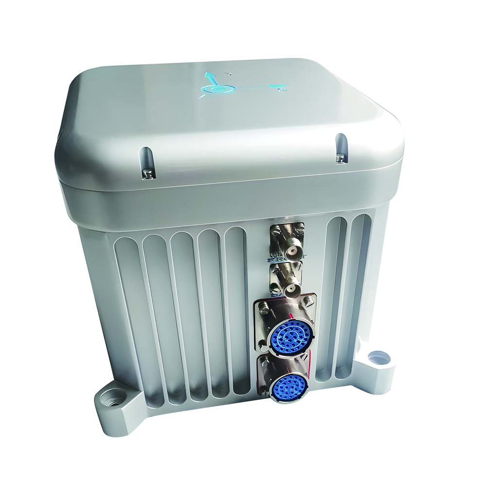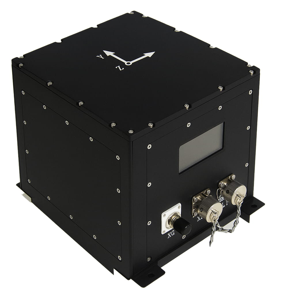
Волоконно-оптическая инерциальная навигационная система M4000 обеспечивает двойной прорыв в точности и надежности для морской съемки и картографии.
Основная сложность в морской съемке заключается в точном определении положения, ориентации и состояния движения съемочной платформы в открытом океане, где отсутствуют стабильные внешние ориентиры, что обеспечивает стабильную пространственную привязку для оборудования обнаружения, такого как гидролокатор. Традиционные решения на основе GPS и гирокомпаса могут работать в условиях спокойного моря, однако при сильном волнении качка, крен и боковое движение судна могут серьезно повлиять на точность измерений, не говоря уже о сложных подводных каньонах или районах с электромагнитными помехами, где прерывания сигнала GPS могут полностью остановить съемочную миссию.
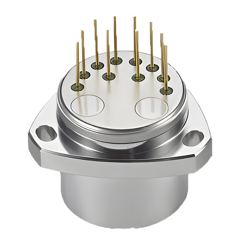
Инерциальная навигационная система M4000 на основе волоконной оптики, разработанная компанией Micro-Magic Inc., была специально создана для решения этой критической проблемы. Выдающиеся характеристики системы M4000 начинаются с ее прочного волоконно-оптического инерциального ядра. Система объединяет внутри себя три высокоточных волоконно-оптических гироскопа и три гибких кварцевых акселерометра, образуя стабильную и надежную автономную основу для измерения параметров, с погрешностью нулевого смещения гироскопа лучше 0,02 °/ч и ежемесячной повторяемостью смещения акселерометра менее 200 мкг. Эта основа позволяет системе поддерживать точность курса 0,3° секφ и точность ориентации 0,02° в течение 1 часа даже в чисто инерциальном режиме при прерывании спутникового сигнала, обеспечивая непрерывную и бесперебойную опорную точку ориентации для геодезических работ и гарантируя пространственно-временную непрерывность сбора данных.
Настоящий технологический прорыв заключается в его мощной возможности объединения информации из нескольких источников. M4000 — это не просто набор датчиков, а интеллектуальная интегрированная навигационная система с волоконно-оптической инерциальной навигацией в качестве ядра, тесно связанная со спутниковой навигацией GNSS и доплеровским одометром DVL. При хорошем сигнале спутниковой навигации система тесно взаимодействует со встроенным или внешним GPS (поддерживая дифференциальный и даже RTK) для эффективной коррекции накопленных инерциальных ошибок, повышения точности курса до 0,2°·с·φ и предоставления высокоточной информации о положении и скорости в реальном времени. Что еще более важно, в условиях потери сигнала спутниковой навигации, вызванной подводными, фьордовыми или сложными морскими условиями, система может беспрепятственно интегрировать DVL, непрерывно подавлять расходимость навигационных ошибок, используя информацию о скорости дна или воды, и обеспечивать бесперебойные навигационные решения и точность при выполнении критически важных задач. Возможность интеллектуальной адаптации и плавного переключения между режимами «комбинирования со спутниковой навигацией» и «чистой инерцией» дает исследовательским судам или подводным аппаратам свободу работать в любых погодных и морских условиях.
В ответ на требования к точному восприятию вертикального движения в морской геодезии, в M4000 специально оптимизирована функция измерения качки с точностью до 5 сантиметров или 5% амплитуды качки. Она эффективно отделяет собственное движение судна от волновых возмущений, обеспечивая важную компенсацию движения для данных многолучевого измерения глубины и напрямую повышая качество моделей рельефа морского дна. В то же время система учитывает удобство и стабильность инженерных приложений. Встроенная карта памяти объемом 32 ГБ позволяет записывать полные навигационные данные в течение длительного времени и считывать их удаленно по сети; богатый набор настраиваемых интерфейсов и многоканальные синхронные импульсные выходы позволяют гибко подключаться к различным геодезическим датчикам и обеспечивать пространственно-временную синхронизацию данных. Встроенный интерфейс конфигурации IE делает управление устройством и привязку параметров (таких как отклонение установки и компенсация плеча рычага) более интуитивно понятными и удобными, значительно снижая технический порог для интеграции и обслуживания системы.
От масштабного сканирования местности в обширных морских районах до точных подводных инженерных исследований, от точного позиционирования судов для надводных изысканий до надежной навигации автономных подводных аппаратов, волоконно-оптическая инерциальная навигационная система M4000 с ее высокопроизводительным инерциальным ядром, интегрированной навигационной стратегией глубокого слияния и высокотехнологичной конструкцией становится ключевым фактором повышения качества и эффективности работы морских исследовательских данных. Она не только представляет собой шаг вперед в области высокоточных приборов, но и демонстрирует мощную способность предоставлять всепогодные, высоконадежные и интегрированные решения в области высокотехнологичной океанской навигации и позиционирования, закладывая прочную технологическую основу для управления океаном и расширения морских территорий.

Xml политика конфиденциальности блог Карта сайта
Авторские права @ Микро-Магия Инк Все права защищены.
 ПОДДЕРЖИВАЕТСЯ СЕТЬ


 русский