Получите информацию о товаре за одну минуту!
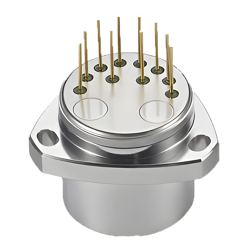
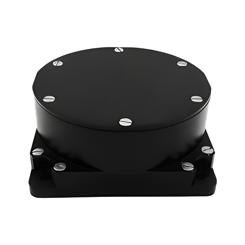
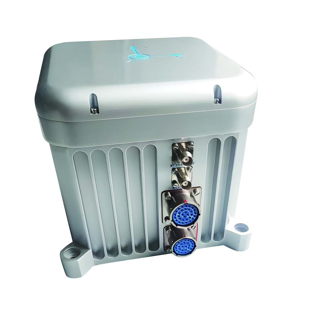
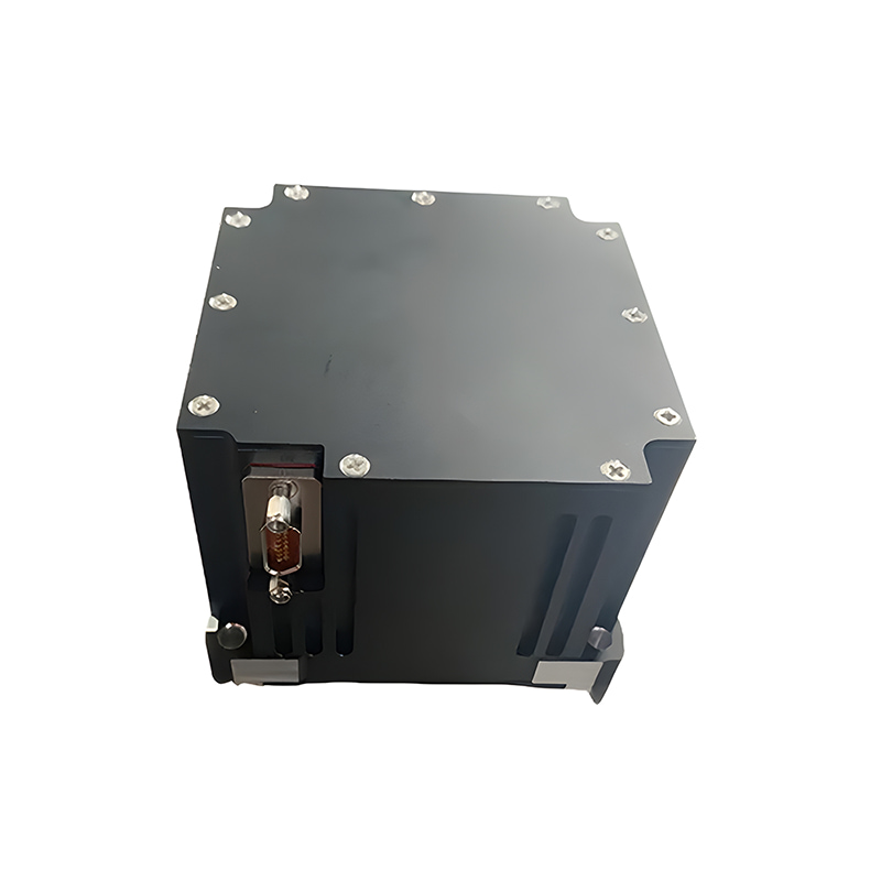
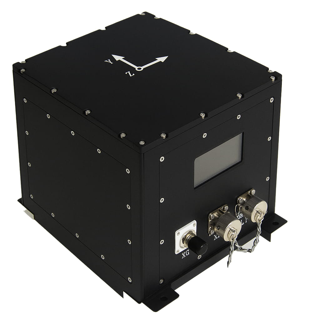
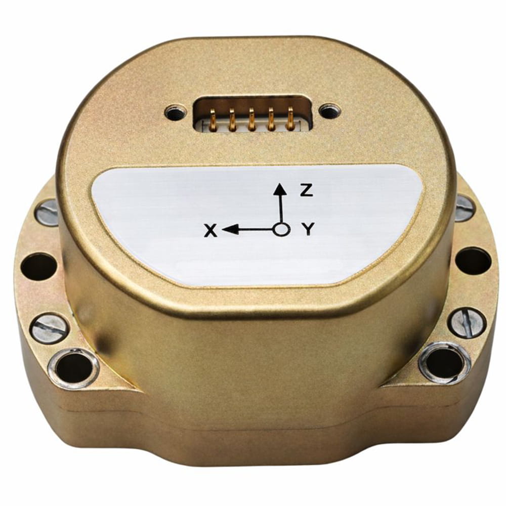
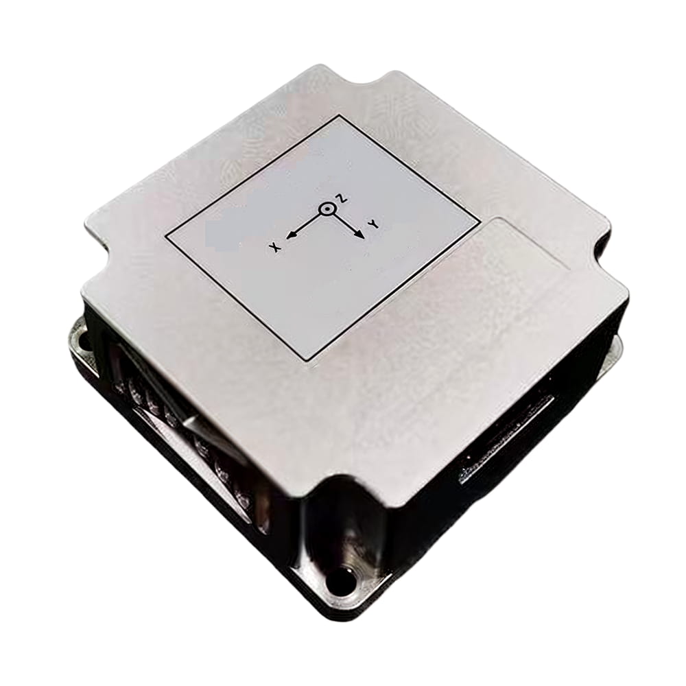
В условиях бурного развития технологий автономного вождения, дронов и робототехники высокоточные и надежные навигационные системы стали «мозгом» интеллектуальных устройств. Технология инерциальной навигации MEMS в сочетании с двухантенной спутниковой навигационной системой I3700запущено Микро-Магия Инкиспользует высокоточные МЭМС-технологии гироскопы, акселерометры, Многорежимные многочастотные GNSS-приемники обеспечивают быструю и высокоточную ориентацию и интегрированные навигационные функции. Устройство в реальном времени вычисляет положение, курс, ориентацию, скорость и другую информацию о несущей, устойчиво к препятствиям и многолучевым помехам, обеспечивая долговременную, высокоточную и надежную навигацию в горных туннелях, городских каньонах, автомобилях, высокоскоростных железных дорогах и других районах. Поддерживает функцию GNSS RTK в реальном времени, предоставляет стандартизированный универсальный пользовательский протокол и обладает хорошей масштабируемостью. Предоставляет удобные навигационные решения для многодоменных приложений во всех сценариях. Одновременно с этим, I3700 прошел защиту IP68 и сертификацию CE, и может нормально работать в суровых условиях, отвечая требованиям надежной конструкции промышленного класса.
Для решения проблемы больших ошибок при вычислении ориентации предложена система вычисления ориентации на основе слияния данных массива MEMS-IMU. Для слияния данных массива MEMS-IMU используется метод оптимизации многоинформационных векторов, а для вычисления ориентации движущегося носителя применяется метод динамического фильтра Калмана. Это позволяет повысить точность вычисления ориентации в сложных динамических движениях.
Встроенный модуль позиционирования с двумя антеннами и направленной GNSS-системой поддерживает все основные мировые спутниковые навигационные системы, обеспечивая высокоточное и быстрое позиционирование и ориентацию. Одновременная совместимость со всеми частотными диапазонами гарантирует оптимальную точность позиционирования в любой точке мира. Встроенный спутниковый приемник обладает высокой помехоустойчивостью и способен обеспечивать точное позиционирование даже в сложных электромагнитных условиях.
Технология инерциальной навигации + GNSS в сочетании с разработанным нами высокоточным интегрированным навигационным алгоритмом обеспечивает точность горизонтального позиционирования 0,8 см + 1 ppm и точность определения курса 0,2°. Даже при временной потере сигналов GNSS (например, в туннелях или подземных гаражах) стабильные навигационные данные могут непрерывно передаваться через инерциальные датчики (стабильность нулевого смещения гироскопа 2,5°/ч, нулевое смещение ускорения 30 мкг). В то же время алгоритмы слияния данных из нескольких источников поддерживают внешнюю одометрию, доплеровский измеритель скорости (DVL) и другие вспомогательные датчики, повышая надежность локализации в сложных условиях.
Полная поддержка интерфейсов: RS232/422, CAN (SAE J1939), сигналы синхронизации PPS, совместимость с дифференциальным доступом 4G DTU, простота подключения к внешним устройствам, таким как LiDAR и камеры. Вывод сообщений NMEA, RTCM, бинарных протоколов и стандарта J1939, с поддержкой различных протоколов для удовлетворения потребностей промышленной и автомобильной связи.
Режим Plug and Play (PnP) делает использование более гибким, предлагая конфигурации по умолчанию, адаптированные к распространенным сценариям, и поддержку настройки режимов работы одним щелчком мыши (бортовой, судовой, авиационный, базовая станция). Удобный интерфейс разработки, поддерживающий запись данных в реальном времени и визуальную отладку, сокращает цикл интегрированной разработки.
1. Дроны и беспилотные летательные аппараты: В логистических операциях по распределению и досмотру I3700 обеспечивает позиционирование с точностью до сантиметра и стабильную ориентацию для обеспечения точного управления на сложных траекториях.
2. Интеллектуальное сельское хозяйство: в сочетании с системой автоматического управления сельскохозяйственной техникой погрешность навигации между гребнями составляет менее 2 см, что значительно повышает эффективность посева и внесения удобрений.
3. Исследование океана и беспилотные суда: конструкция с защитой IP68 для работы во влажной среде соленых брызг, функция направленного движения с двумя антеннами для обеспечения точности курса судна, а также помощь в гидрологических исследованиях и научных изысканиях.
4. Промышленные роботы: В сценариях использования автоматизированных транспортных средств на складах и при обработке грузов на заводах отслеживание траектории движения с точностью до миллиметра достигается путем координации с внешними устройствами посредством синхронных функций ввода и вывода.
I3700 предлагает несколько вариантов интерфейса (MI0/MI1/MI2) для удовлетворения потребностей различных отраслей. В стандартный комплект для разработки входит подробный технический документ, а также возможность индивидуальной настройки. Устройство может подключаться к станциям CORS, таким как Qian Xun и Mobile, или создавать собственную опорную станцию RTK для обеспечения высокоточной связи по всей стране.
I3700 точно измеряет окружающий мир и надежно управляет будущим. Независимо от того, являетесь ли вы разработчиком, стремящимся к передовым технологиям, или специалистом, глубоко вовлеченным в отрасль, I3700 — это устройство поможет вам. I3700станет вашим надежным партнером в изучении интеллектуальной навигации.

Xml политика конфиденциальности блог Карта сайта
Авторские права @ Микро-Магия Инк Все права защищены.
 ПОДДЕРЖИВАЕТСЯ СЕТЬ


 русский